
Three Mystery Beaches on Hilton Head Island
The beach on Hilton Head Island is a house of mysteries. Around every bend is a clue about places of great battles, lost plantations, landscapes reshaped. This Island keeps its secrets at the water’s edge. But you can discover the clues if you know where to look.
GONE WITH THE WAVES
Dolphin Head beach is a dynamic strand. Located on the northern tip of the Island, this shoreline has retreated back at least 1,000 yards. Relentless tidal currents in Port Royal Sound have rolled the beach into the nearby salt marsh. At high tide this strand is only a few yards wide.
At ebb (low) tide, vast gray sand flats appear. The landscape is a gallery of things past: bleached live oak logs, clumps of ancient marsh grass, tidal pools that lure shorebirds, and most mysterious: odd blocks encrusted with oyster shells. These were tabby cement footings on the renowned Myrtle Bank Plantation. Here William Elliot was the first to cultivate long-staple Sea Island Cotton, which brought great wealth to Hilton Head Island planters—before the Civil War washed away the plantation economy, and the rising sea level washed away the Elliot’s plantation manse.
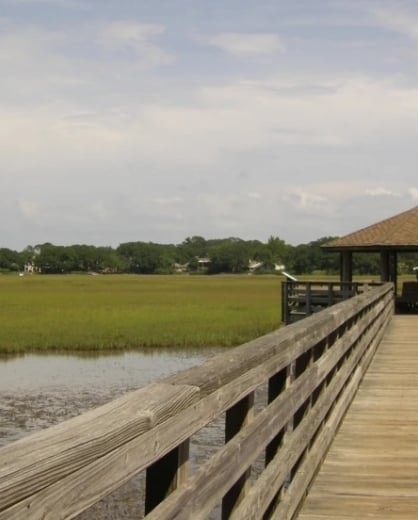
THE ISLAND EVERGLADES
The “Folly” is a creek that cuts across the beach between Singleton Beach Road and Burke’s Beach Road, south of the Folly Field community. Powerful tidal currents pour inland through the Folly and nourish a bay-shaped salt marsh behind rows of dunes. The Folly marsh is a nature treasure for two reasons. First, the shallow tidal grassland is a refuge for wildlife: wading birds, osprey, and white-tailed deer and coastal fish. Second, Folly Creek is a secret memory, a remnant of an inland marsh that ran parallel to the shore, like a Lowcountry Everglades. The Folly flowed all the way to Sea Pines, where it turned back into the ocean. About 50 years ago, this little river of grass was converted to a matrix of lagoons, canals, and even a golf course over 50 years ago. Folly Creek and marsh is all that remains of the ancient waterway.
WHERE THE CIVIL WAR ENDED
On November 7, 1861, a Union armada anchored off Scarborough Head, the northeastern heel of foot-shaped Hilton Head Island and blasted Confederate defenses at Confederate Fort Walker. Rebel troops fled the decimated fort as Union forces invaded, effectively ending the Civil War—at least on Hilton Head Island. What is today vibrant community and resort was then the central port for the Atlantic coastal blockade by the U.S. Navy of southern ports, and the station for 40,000 blue-coated troops.
The Scarborough Head beach (now called the Port Royal beach) is flat and over 100 yards wide at low tide. If you know where to look at the water’s edge, you may see a remnant post, wave-worn and encrusted with marine life. This might have supported the naval dock, 1,000 feet in length. It is another clue that great mysteries are embedded in the Island’s vast beaches.
More Trending Stories

Hidden Gems of the Lowcountry
Beyond its pristine beaches and iconic landmarks, there’s a more secluded side to Hilton Head Island for those who prefer the roads, trails, and...

Embracing Nature in Hilton Head Island
As the summer gives way to the warm hues of autumn's soft tones, wildlife that typically lays low bursts back onto the scene. A haven for nature...

Finding Wellness on Hilton Head Island
Here on Hilton Head Island, wellness weaves through almost every activity and landscape. From the world-class golf courses and scenic cycling paths to...