

Yours to Discover
Hilton Head Island is a wonderland of white-sand beaches, tidal creeks, towering live oaks, and winding pathways. A place where classic small-town charm meets refined coastal elegance. Where the catch of the day is tonight’s family-style feast. Where the past is honored and traditions celebrated. And where laughter, connection, and lifelong memories are made.
Trip Ideas & Itineraries

5 Reasons Why a Visit to Hilton Head Island Should Be on Your New Year's Resolutions List

Looking Ahead to Our Favorite Events of 2024

Itinerary: Way Beyond the Boardroom

9 Insider Tips on How To Do a Golf Trip on Hilton Head Island

Your Guide To Fishing on Hilton Head Island

The Kayaker's Guide to Hilton Head Island

10 Family-Friendly Activities on Hilton Head Island
Unwind in Style
Experience unexpected charms and unparalleled Southern hospitality. Browse accommodations on Hilton Head Island and book your home away from home today.

Hotels, Inns & Resorts

Vacation Homes & Villas

Spa Resorts

Live Here
HILTON HEAD ISLAND ESCAPESSm
Check out the hottest Deals of the season.


The Westin Hilton Head Island Resort & Spa
Oceanfront luxury meets southern hospitality at The Westin Resort & Spa. Wellness-inspired amenities like our three oceanfront pools, Peloton studio, and on-site Heavenly Spa by Westin, allow guests to feel their best while traveling.
Sonesta Resort Hilton Head Island
Enjoy the charm and warmth of one of areas top resorts. Nestled along the coast with stunning 360º views and lush landscapes as far as the eye can see, our award-winning Sonesta Resort is a premier destination for a relaxing getaway.
Omni Hilton Head Oceanfront Resort
Every destination has a soul worth discovering. At Omni, we’ll bring you the true essence of Hilton Head Island. Whether it’s in the local knowledge offered with a smile or the locally sourced cuisine, let us make the most of your next escape.
Beach House Resort
Get ready for a brand-new Beach House experience in 2024! Be one of the first guests to enjoy the revamped Tiki Hut, complete with beachfront stage, plus newly renovated pool with poolside cabanas and ocean views.
Hilton Beachfront Resort & Spa Hilton Head Island
With an exceptional location on the sandy shores of the Atlantic, our hotel offers a distinctive blend of comfort and sophistication. Make yourself at home in spacious accommodations and experience luxury with magnificent coastline or resort views.
The Sea Pines Resort
Refresh the spirit, encourage the unscripted and return to the classic family vacation as a guest of The Sea Pines Resort. Spanning the southern third of Hilton Head Island, and located along 5,000 oceanfront acres, The Sea Pines Resort has been a quiet retreat for more than 50 years.


Hilton Head Island Travel Offers

Vagabond Cruise-Harbour Town
Hilton Head's original sightseeing and excursion cruise operator.
Learn More
Fly to Hilton Head Island Airport
Daily Flights on Major Airlines – to Hilton Head Island (HHH)!
Learn More
Oceanfront Rentals
Oceanfront and oceanside vacation rentals on Hilton Head Island’s Best Beach
Learn More
The Sea Pines Resort Escape Package
Enjoy up to a $200 resort credit when you book a weekly stay in a home or villa this spring or summer.
Learn More
The Westin Hilton Head Island Resort
Enjoy newly renovated rooms, suites, and relaxing amenities at this beachfront resort.
Learn More
Hilton Head Vacations, Inc.
Luxury Homes and Condos. Dream Vacations await on Hilton Head Island!! Book now!
Learn More
The Inn & Club at Harbour Town
Stay three consecutive nights and receive the fourth night free.
Learn More
Heritage Golf Collection
Award-winning courses offer everything you need for a South Carolina golf getaway.
Learn More
Hampton Inn Hilton Head Island
Located mid-island with complimentary hot breakfast and heated pool.
Learn More
Island Time
Memorable experiences await with luxury homes and villas and concierge-level services so everyone can fully enjoy their vacation.
Learn More
Hilton Head Island in the Media
See what top travel publications from Travel + Leisure to Condé Nast Traveler and more, have to say about our destination.
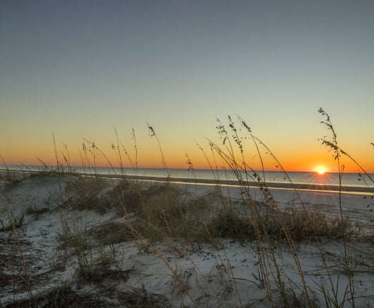
#LowcountryLife
Miles of pristine, wide beaches. Spectacular sunrises and sunsets. Relax, explore, and reconnect with nature.
Discover the magical Lowcountry and be inspired by the beauty, charm, history, and spirit of Hilton Head Island!